Flat Detail Data Browser for Oracle Database
22 Jan 2024
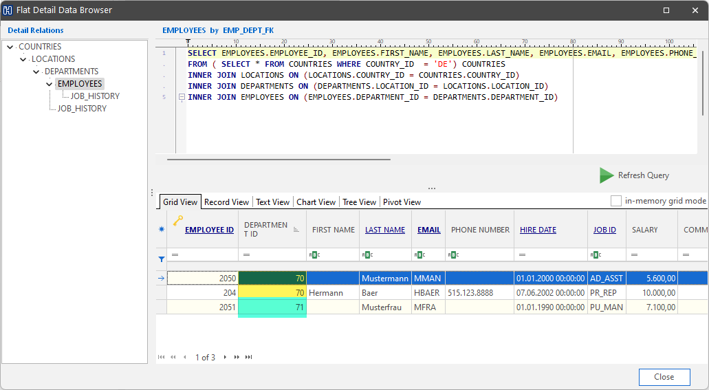
The Flat Detail Data Browser for Oracle Database collects data from detail and all subdetail tables jumping the hierarchy.
22 Jan 2024
07 Nov 2023
18 Sep 2023
03 Mar 2023
23 Jan 2023
20 Sep 2022
18 Feb 2022
06 Dec 2021
19 Apr 2021
23 Feb 2021